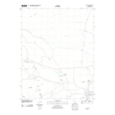
2010 Map of La Veta
USGS Topo · Published 2010About this map
The town of La Veta anchors this 2010 survey of Huerfano County, situated where the Cucharas River meets the drainages of Middle Creek and Indian Creek. This region is defined by a deep history of resource extraction, evidenced by the high concentration of coal mining sites northwest of town. Small-scale industrial markers like the Lone Pine Mine, Reliance Mine, and the colorfully named City Slicker Mine are scattered across the landscape near South Abeyta Creek. Local infrastructure is further highlighted by the La Veta Landing Field and the Cuchara Valley at La Veta Airport, serving the community near Pinon Hill. For genealogists, the map identifies the Oak View Cemetery north of the Occidental settlement, while environmental researchers can trace water management through the Dyer Ditch and the Owens Reservoir Number 2.
Find a feature on this map
45 named features on this map. Tap any name to fly to it.
Don’t see what you’re looking for? This feature index may not catch every label — zoom into the map to look around manually.
Map Details
Editions of this 2010 La Veta Map
This is the sole edition of this map. No revisions or reprints were ever made.
Other maps of this area

1889 · Huerfano Park
USGS Topo · 1:125,000

1891 · Walsenburg
USGS Topo · 1:125,000

1891 · Spanish Peaks
USGS Topo · 1:125,000

1892 · Huerfano Park
USGS Topo · 1:125,000

1893 · Spanish Peaks
USGS Topo · 1:125,000

1894 · Walsenburg
USGS Topo · 1:125,000

1895 · Spanish Peaks
USGS Topo · 1:125,000

1897 · Walsenburg
USGS Topo · 1:125,000

1897 · Spanish Peaks
USGS Topo · 1:125,000

1900 · Spanish Peaks
USGS Topo · 1:125,000