2022 Map of La Veta
USGS Topo · Published 2022About this map
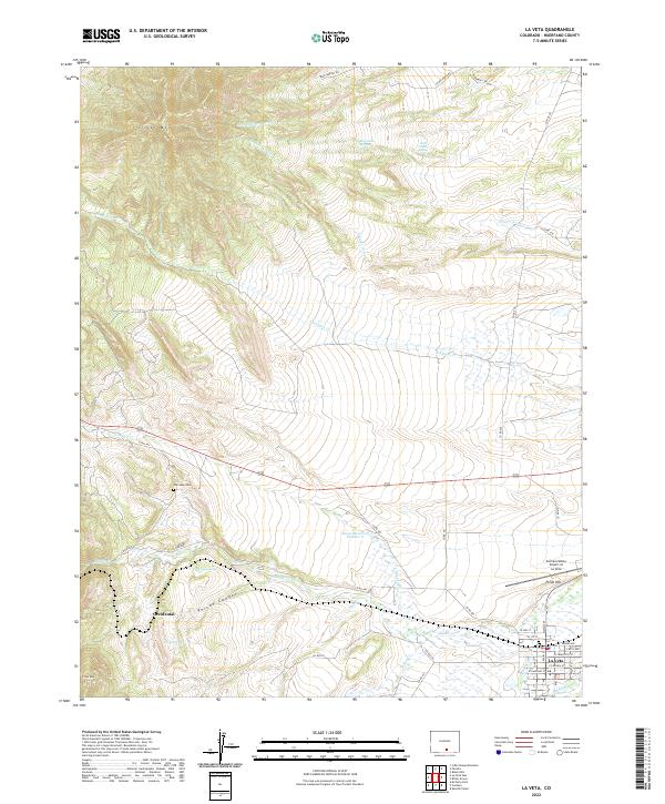
Silver Mtn and the surrounding peaks of the Sangre de Cristo foothills define this Huerfano County landscape, where the town of La Veta sits along the Cucharas River. This modern survey reveals a complex network of arroyos and creeks, including Dog Springs Arroyo and Chavez Arroyo, which drain the higher elevations into the valley below. The town's grid is clearly established, centered on North Main Street and East Francisco Street, while the local aviation history is preserved at the Cuchara Valley Airport at La Veta.
Find a feature on this map
51 named features on this map. Tap any name to fly to it.
Don’t see what you’re looking for? This feature index may not catch every label — zoom into the map to look around manually.
Map Details
Editions of this 2022 La Veta Map
This is the sole edition of this map. No revisions or reprints were ever made.