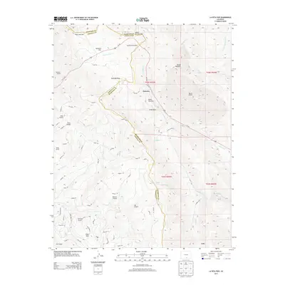
2013 Map of La Veta Pass
USGS Topo · Published 2013About this map
La Veta Pass and the surrounding high-altitude terrain dominate this 2013 survey of the boundary between Huerfano Co and Costilla Co. The landscape is defined by its strategic mountain crossings and the winding path of Us-160, which traverses the peaks near North La Veta Pass. The settlement of Muleshoe sits at the base of Dump Mountain, serving as a central point for a network of rural routes like Co RD-168 and Laveta Acres RD.
Find a feature on this map
69 named features on this map. Tap any name to fly to it.
Don’t see what you’re looking for? This feature index may not catch every label — zoom into the map to look around manually.
Map Details
Editions of this 2013 La Veta Pass Map
This is the sole edition of this map. No revisions or reprints were ever made.
Other maps of this area

1889 · Huerfano Park
USGS Topo · 1:125,000

1892 · Huerfano Park
USGS Topo · 1:125,000

1954 · Trinidad
USGS Topo · 1:250,000

1955 · Trinidad
USGS Topo · 1:250,000

1958 · Trinidad
USGS Topo · 1:250,000

1959 · Trinidad
USGS Topo · 1:250,000

1963 · Mc Carty Park
USGS Topo · 1:24,000

1963 · La Veta Pass
USGS Topo · 1:24,000
1963 · La Veta
USGS Topo · 1:24,000
1963 · Cuchara
USGS Topo · 1:24,000