1963 Map of La Veta
USGS Topo · Published 1966About this map
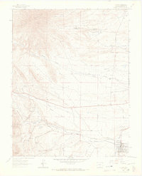
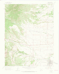
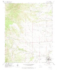
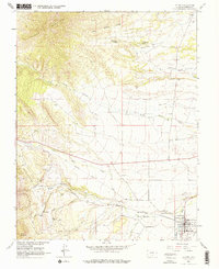
Silver Mountain dominates the northern landscape of this 1963 survey, casting its shadow over a network of mountain springs and arroyos. The town of La Veta is positioned in the southeast, serving as a hub for the region's ranching and transit activities. The Denver and Rio Grande Western Railroad follows the natural contours of the land, cutting through the valleys near Middle Creek and South Abeyta Creek.
Find a feature on this map
26 named features on this map. Tap any name to fly to it.
Don’t see what you’re looking for? This feature index may not catch every label — zoom into the map to look around manually.
Map Details
Editions of this 1963 La Veta Map
4 editions found
Other maps of this area

1889 · Huerfano Park
USGS Topo · 1:125,000

1891 · Walsenburg
USGS Topo · 1:125,000

1891 · Spanish Peaks
USGS Topo · 1:125,000

1892 · Huerfano Park
USGS Topo · 1:125,000

1893 · Spanish Peaks
USGS Topo · 1:125,000

1894 · Walsenburg
USGS Topo · 1:125,000

1895 · Spanish Peaks
USGS Topo · 1:125,000

1897 · Walsenburg
USGS Topo · 1:125,000

1897 · Spanish Peaks
USGS Topo · 1:125,000

1900 · Spanish Peaks
USGS Topo · 1:125,000