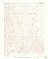
1963 Map of Cuchara
USGS Topo · Published 1966About this map
The Cucharas River cuts a prominent path through this Huerfano County landscape, flowing north toward the corporate boundary of La Veta. The area is defined by the high-elevation terrain of the San Isabel National Forest, where dramatic vertical features like the Devils Stairsteps and Profile Rock rise above the deep drainages of Huestes Canyon and Magpie Canyon. In the southern portion of the quadrangle, the settlement of Cuchara serves as a focal point near the headwaters of White Creek and Chaparral Creek.
Find a feature on this map
55 named features on this map. Tap any name to fly to it.
Don’t see what you’re looking for? This feature index may not catch every label — zoom into the map to look around manually.
Map Details
Editions of this 1963 Cuchara Map
4 editions found
Other maps of this area

1889 · Huerfano Park
USGS Topo · 1:125,000

1891 · Walsenburg
USGS Topo · 1:125,000

1891 · Spanish Peaks
USGS Topo · 1:125,000

1892 · Huerfano Park
USGS Topo · 1:125,000

1893 · Spanish Peaks
USGS Topo · 1:125,000

1894 · Walsenburg
USGS Topo · 1:125,000

1895 · Spanish Peaks
USGS Topo · 1:125,000

1897 · Walsenburg
USGS Topo · 1:125,000

1897 · Spanish Peaks
USGS Topo · 1:125,000

1900 · Spanish Peaks
USGS Topo · 1:125,000