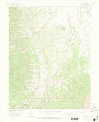
1963 Map of Cuchara
USGS Topo · Published 1972About this map
The mountain settlement of Cuchara serves as a gateway to the high-country drainages of the San Isabel National Forest in this early 1960s survey. The landscape is defined by the headwaters of the Cucharas River, which gathers strength from numerous tributaries including Echo Creek, White Creek, and Cottonwood Creek. Water management for the surrounding valley is evident through a series of high-altitude catchments like Town Lakes, HR Carson Reservoir, and the Mc Donald Reservoir. Distinctive geological features dominate the eastern ridges, most notably the striking formations of the Devils Stairsteps and Profile Rock. Throughout the canyons, markers of early 20th-century activity are visible, including several unnamed mines and prospects, alongside a gravel pit near the Cucharas River.
Find a feature on this map
54 named features on this map. Tap any name to fly to it.
Don’t see what you’re looking for? This feature index may not catch every label — zoom into the map to look around manually.
Map Details
Editions of this 1963 Cuchara Map
4 editions found
Other maps of this area

1889 · Huerfano Park
USGS Topo · 1:125,000

1891 · Walsenburg
USGS Topo · 1:125,000

1891 · Spanish Peaks
USGS Topo · 1:125,000

1892 · Huerfano Park
USGS Topo · 1:125,000

1893 · Spanish Peaks
USGS Topo · 1:125,000

1894 · Walsenburg
USGS Topo · 1:125,000

1895 · Spanish Peaks
USGS Topo · 1:125,000

1897 · Walsenburg
USGS Topo · 1:125,000

1897 · Spanish Peaks
USGS Topo · 1:125,000

1900 · Spanish Peaks
USGS Topo · 1:125,000