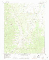
1963 Map of Cuchara
USGS Topo · Published 1991About this map
San Isabel National Forest dominates the southern landscape of this 1963 survey, where high-altitude terrain transitions from the settlement at Cuchara toward the towering White Peaks. The drainage of the Cucharas River serves as the primary corridor for development, flowing north toward the Corporate Boundary of La Veta. Along the valley floor, the landscape is marked by small-scale resource extraction and water management, evidenced by the Linscott Mine and several irrigation structures like the Butte Ditch and Mc Donald Reservoir. Distinctive geological formations define the western ridge lines, including the dramatic Devils Stairsteps and Profile Rock. The map illustrates a network of 4WD and Jeep trails that provide access to remote areas like Price Canyon and Coleman Ridge, reflecting a mid-century period of recreation and rugged backcountry exploration.
Find a feature on this map
62 named features on this map. Tap any name to fly to it.
Don’t see what you’re looking for? This feature index may not catch every label — zoom into the map to look around manually.
Map Details
Editions of this 1963 Cuchara Map
4 editions found
Other maps of this area

1889 · Huerfano Park
USGS Topo · 1:125,000

1891 · Walsenburg
USGS Topo · 1:125,000

1891 · Spanish Peaks
USGS Topo · 1:125,000

1892 · Huerfano Park
USGS Topo · 1:125,000

1893 · Spanish Peaks
USGS Topo · 1:125,000

1894 · Walsenburg
USGS Topo · 1:125,000

1895 · Spanish Peaks
USGS Topo · 1:125,000

1897 · Walsenburg
USGS Topo · 1:125,000

1897 · Spanish Peaks
USGS Topo · 1:125,000

1900 · Spanish Peaks
USGS Topo · 1:125,000