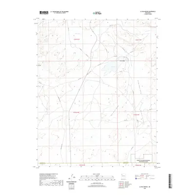
2020 Map of La Vida Mission
USGS Topo · Published 2020About this map
Lake Valley sits at the heart of this high-desert landscape in Northwest New Mexico, where the transition between San Juan and McKinley counties is marked by a network of drainage washes and service routes. The northern reaches are defined by the Chaco River, while the southern boundary includes a portion of the Chaco Culture National Historical Park. The terrain is characterized by broad depressions such as Rock Point Valley and Yellow Point Valley, which are flanked by prominent features like Red Hill. Water is scarce but centralized at Juans Lake, a focal point near the intersection of several county and Indian Service roads. This modern survey illustrates the sparse but vital infrastructure of the Eastern Navajo Agency, showing the path of Kim-me-ni-oli Wash as it winds through Kim-me-ni-oli Valley.
Find a feature on this map
29 named features on this map. Tap any name to fly to it.
Don’t see what you’re looking for? This feature index may not catch every label — zoom into the map to look around manually.
Map Details
Editions of this 2020 La Vida Mission Map
This is the sole edition of this map. No revisions or reprints were ever made.
Other maps of this area

1886 · Wingate
USGS Topo · 1:250,000

1889 · Chaco
USGS Topo · 1:250,000

1892 · Wingate
USGS Topo · 1:250,000

1892 · Chaco
USGS Topo · 1:250,000

1954 · Shiprock
USGS Topo · 1:250,000

1954 · Gallup
USGS Topo · 1:250,000

1958 · Gallup
USGS Topo · 1:250,000

1958 · Shiprock
USGS Topo · 1:250,000

1959 · Shiprock
USGS Topo · 1:250,000

1959 · Gallup
USGS Topo · 1:250,000
Featured Places
- Eastern Navajo Agency, NM
- Tsaya, Eastern Navajo Agency
- Lake Valley, Eastern Navajo Agency
- San Juan County, NM
- McKinley County, NM