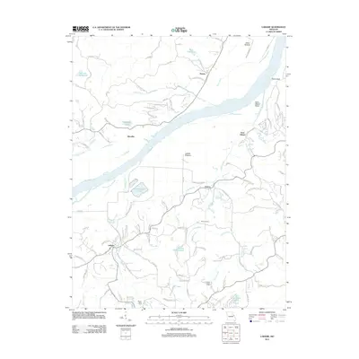
2012 Map of Labadie
USGS Topo · Published 2012About this map
Labadie and Saint Albans anchor this 2012 survey of the Missouri River valley, where the waterway carves through the landscape between Labadie Bottoms and Darst Bottoms. The river's influence is evident in the presence of Saint Albans Island and the proximity of industrial and agricultural sites, including the Purina Mills Farm and a large Ash Disposal Pond. Local history and education are represented by the Becker School, while recreational areas like Fiddle Creek Camp and Las Brisas Lake appear in the hills south of the river.
Find a feature on this map
103 named features on this map. Tap any name to fly to it.
Don’t see what you’re looking for? This feature index may not catch every label — zoom into the map to look around manually.
Map Details
Editions of this 2012 Labadie Map
This is the sole edition of this map. No revisions or reprints were ever made.
Other maps of this area

1901 · De Soto
USGS Topo · 1:125,000

1903 · O'Fallon
USGS Topo · 1:125,000

1937 · Pacific
USGS Topo · 1:24,000

1937 · Weldon Spring
USGS Topo · 1:24,000

1940 · Eureka
USGS Topo · 1:24,000

1940 · Weldon Spring
USGS Topo · 1:24,000

1944 · Eureka
USGS Topo · 1:24,000

1947 · St. Clair
USGS Topo · 1:62,500

1948 · Augusta
USGS Topo · 1:62,500

1949 · Saint Louis
USGS Topo · 1:250,000