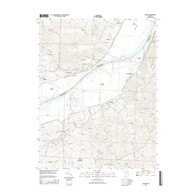
2015 Map of Labadie
USGS Topo · Published 2015About this map
The Missouri River cuts a wide path through the border of Franklin and Saint Charles counties, defining the character of this mid-Missouri landscape. Along its northern banks, the Katy Trl follows the old rail corridor through Matson and Klondike, where Klondike Lake sits near the river's edge. This area is marked by significant alluvial terrain like Darst Bottoms and Hancock Bottom, which have historically supported the region's agricultural interests. South of the river, the landscape transitions into the hills around Labadie and Gray Summit, where the Union Pacific RR provides a primary transportation artery. The presence of the Labadie Power Plant Reservoir highlights the industrial footprint near Labadie Bottoms, while established communities like Saint Albans and Augusta anchor the residential and commercial life of the river valley. Numerous smaller waterways, including Fiddle Creek and Tavern Cr, drain the upland areas into the main river channel.
Find a feature on this map
123 named features on this map. Tap any name to fly to it.
Don’t see what you’re looking for? This feature index may not catch every label — zoom into the map to look around manually.
Map Details
Editions of this 2015 Labadie Map
This is the sole edition of this map. No revisions or reprints were ever made.
Other maps of this area

1901 · De Soto
USGS Topo · 1:125,000

1903 · O'Fallon
USGS Topo · 1:125,000

1937 · Pacific
USGS Topo · 1:24,000

1937 · Weldon Spring
USGS Topo · 1:24,000

1940 · Eureka
USGS Topo · 1:24,000

1940 · Weldon Spring
USGS Topo · 1:24,000

1944 · Eureka
USGS Topo · 1:24,000

1947 · St. Clair
USGS Topo · 1:62,500

1948 · Augusta
USGS Topo · 1:62,500

1949 · Saint Louis
USGS Topo · 1:250,000