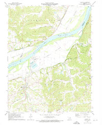
1972 Map of Labadie
USGS Topo · Published 1973About this map
The Missouri River creates a prominent bend as it carves through the landscape, separating Femme Osage in St. Charles County from the industrial and agricultural developments in Boles. This early 1970s survey captures the massive footprint of the Labadie Powerplant and its associated Ash Disposal Ponds, contrasting with the surrounding Hancock Bottom and Labadie Bottoms. Transportation infrastructure is dense, with the Missouri Pacific, Chicago Rock Island and Pacific, and Missouri Kansas Texas railroads all navigating the river valley.
Find a feature on this map
46 named features on this map. Tap any name to fly to it.
Don’t see what you’re looking for? This feature index may not catch every label — zoom into the map to look around manually.
Map Details
Editions of this 1972 Labadie Map
2 editions found
Other maps of this area

1901 · De Soto
USGS Topo · 1:125,000

1903 · O'Fallon
USGS Topo · 1:125,000

1937 · Pacific
USGS Topo · 1:24,000

1937 · Weldon Spring
USGS Topo · 1:24,000

1940 · Eureka
USGS Topo · 1:24,000

1940 · Weldon Spring
USGS Topo · 1:24,000

1944 · Eureka
USGS Topo · 1:24,000

1947 · St. Clair
USGS Topo · 1:62,500

1948 · Augusta
USGS Topo · 1:62,500

1949 · Saint Louis
USGS Topo · 1:250,000