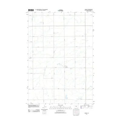
2012 Map of LaBolt
USGS Topo · Published 2012About this map
LaBolt sits at the center of this Grant County landscape, where the agricultural grid of eastern South Dakota meets the winding drainage of the S Fork Yellow Bank River. The settlement pattern is anchored by its local landmarks, including LaBolt Cemetery just east of town and Bethel Cemetery to the west. A high concentration of section roads, such as Co Hwy-28 and various numbered avenues like 473rd Ave, defines the local geography and provides access to the scattered water bodies that dot the prairie. Notable hydrologic features like LaBolt Lake and the marshy expanse of Mud Lake provide a sharp contrast to the precise rectilinear layout of the surrounding farms and homesteads. This 2012 survey captures the enduring rural character of the region, showing how the natural hydrology of the river forks continues to shape the placement of roads and property boundaries.
Find a feature on this map
21 named features on this map. Tap any name to fly to it.
Don’t see what you’re looking for? This feature index may not catch every label — zoom into the map to look around manually.
Map Details
Editions of this 2012 LaBolt Map
This is the sole edition of this map. No revisions or reprints were ever made.
Other maps of this area

1953 · Milbank
USGS Topo · 1:250,000

1953 · Watertown
USGS Topo · 1:250,000

1958 · Milbank
USGS Topo · 1:250,000

1958 · Watertown
USGS Topo · 1:250,000

1970 · Goodwin
USGS Topo · 1:24,000

1973 · Twin Brooks
USGS Topo · 1:24,000

1973 · LaBolt
USGS Topo · 1:24,000

1973 · Tunerville
USGS Topo · 1:24,000
1973 · Milbank West
USGS Topo · 1:24,000

1973 · Stockholm
USGS Topo · 1:24,000