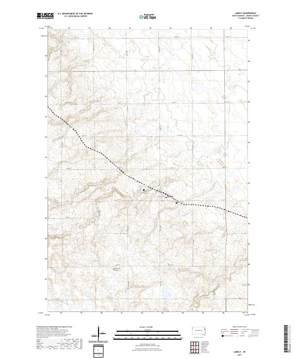
2021 Map of LaBolt
USGS Topo · Published 2021About this map
LaBolt serves as the primary hub of this corner of Grant County, situated upon the expansive plateau of the Coteau des Prairies. This glacial upland feature dominates the local topography, influencing the drainage patterns seen in the headwaters of the S Fork Yellow Bank River as it meanders through the southeastern sections. The settlement's local history is anchored by the LaBolt Cem and the specific LaBolt Gravesite, while LaBolt Lake provides a natural landmark just northwest of the town center. The landscape is strictly organized by the Public Land Survey System, with a dense grid of rural roads including Co HWY 28 and E Co HWY 20 that facilitate movement between the surrounding agricultural tracts.
Find a feature on this map
20 named features on this map. Tap any name to fly to it.
Don’t see what you’re looking for? This feature index may not catch every label — zoom into the map to look around manually.
Map Details
Editions of this 2021 LaBolt Map
This is the sole edition of this map. No revisions or reprints were ever made.
Other maps of this area

1953 · Milbank
USGS Topo · 1:250,000

1953 · Watertown
USGS Topo · 1:250,000

1958 · Milbank
USGS Topo · 1:250,000

1958 · Watertown
USGS Topo · 1:250,000

1970 · Goodwin
USGS Topo · 1:24,000

1973 · Twin Brooks
USGS Topo · 1:24,000

1973 · LaBolt
USGS Topo · 1:24,000

1973 · Tunerville
USGS Topo · 1:24,000
1973 · Milbank West
USGS Topo · 1:24,000

1973 · Stockholm
USGS Topo · 1:24,000