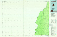
1986 Map of Lac Etchemin
USGS Topo · Published 1986About this map
The St John River and its intricate network of tributaries define this remote section of Somerset County, Maine, during the mid-1980s. This planimetric survey documents a landscape dominated by the timber industry and the international boundary between Quebec and Maine. The presence of Billy-Jack Depot and La Croix Depot highlights the infrastructure of industrial forestry, where these remote outposts served as hubs for activity in the deep North Woods. The map details the drainage patterns of the Southwest Branch St John River and the headwaters of the North Branch Penobscot River, illustrating how the waterways dictate the transit routes through the township-and-range grid. High points like Hardwood Mountain and Hurricane Hill overlook a mosaic of wetlands including Big Bog and Little St John Lake, providing a clear record of the region's topography before more modern shifts in land management.
Find a feature on this map
46 named features on this map. Tap any name to fly to it.
Don’t see what you’re looking for? This feature index may not catch every label — zoom into the map to look around manually.
Map Details
Editions of this 1986 Lac Etchemin Map
This is the sole edition of this map. No revisions or reprints were ever made.
Other maps of this area

1927 · Sandy Bay
USGS Topo · 1:48,000

1930 · Sandy Bay
USGS Topo · 1:62,500

1944 · Sandy Bay
USGS Topo · 1:62,500

1949 · Jackman
USGS Topo · 1:250,000

1954 · Seboomook Lake
USGS Topo · 1:62,500

1954 · Baker Lake
USGS Topo · 1:62,500

1954 · St. John Pond
USGS Topo · 1:62,500

1954 · Presque Isle
USGS Topo · 1:250,000

1954 · Millinocket
USGS Topo · 1:250,000

1955 · Beaver Pond
USGS Topo · 1:62,500