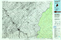
1993 Map of Lac Etchemin
USGS Topo · Published 1993About this map
Monts Notre Dame dominate the northwestern portion of this international survey, providing a backdrop for the dense network of settlements along the Riviere Chaudiere. In the early 1990s, the region was characterized by its transnational connections, centered on the Port of Entry that links Maine and Canada. The map illustrates a stark contrast between the industrial and agricultural clusters of the Chaudiere Valley, including Beauceville and Saint-Georges, and the vast, unorganized timberlands of Somerset County to the southeast. Remote water bodies such as Hurricane Pond and Dole Pond serve as headwaters for the complex drainage systems of the Saint John River Southwest Branch and the North Branch of the Penobscot River. This survey captures the borderland at a time when traditional water-based transport routes had long been replaced by a system of primary and secondary roads connecting isolated towns like Saint-Magloire and Sainte-Justine to the larger centers of the Beauce region.
Find a feature on this map
47 named features on this map. Tap any name to fly to it.
Don’t see what you’re looking for? This feature index may not catch every label — zoom into the map to look around manually.
Map Details
Editions of this 1993 Lac Etchemin Map
This is the sole edition of this map. No revisions or reprints were ever made.
Other maps of this area

1927 · Sandy Bay
USGS Topo · 1:48,000

1930 · Sandy Bay
USGS Topo · 1:62,500

1944 · Sandy Bay
USGS Topo · 1:62,500

1949 · Jackman
USGS Topo · 1:250,000

1954 · Seboomook Lake
USGS Topo · 1:62,500

1954 · Baker Lake
USGS Topo · 1:62,500

1954 · St. John Pond
USGS Topo · 1:62,500

1954 · Presque Isle
USGS Topo · 1:250,000

1954 · Millinocket
USGS Topo · 1:250,000

1955 · Beaver Pond
USGS Topo · 1:62,500