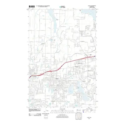
2011 Map of Lacey
USGS Topo · Published 2011About this map
The burgeoning residential and commercial corridors of Lacey and eastern Olympia define this 2011 survey, showing a landscape shaped by both glacial history and modern development. Extensive suburban expansion is evident across Tanglewilde and Thompson Place, while the northeastern corner retains its connection to the Puget Sound via Henderson Inlet and the Nisqually Reach. Inland, a chain of water bodies including Pattison Lake, Hicks Lake, and Chambers Lake provides a natural counterpoint to the busy traffic of Pacific Ave SE and Martin Way E. Finer historical details persist amidst the growth, such as the Mount Tabor Cemetery and the legacy of the timber industry at Union Mill. The map also documents named geographic features like Woods Prairie and Little Chambers Prairie, markers of the open landscapes that once dominated the area before the 21st-century build-out.
Find a feature on this map
62 named features on this map. Tap any name to fly to it.
Don’t see what you’re looking for? This feature index may not catch every label — zoom into the map to look around manually.
Map Details
Editions of this 2011 Lacey Map
This is the sole edition of this map. No revisions or reprints were ever made.
Other maps of this area

1916 · Chehalis
USGS Topo · 1:125,000

1937 · Olympia
USGS Topo · 1:62,500

1940 · Tenino
USGS Topo · 1:62,500

1940 · Anderson Island
USGS Topo · 1:62,500

1944 · Tenino
USGS Topo · 1:62,500

1944 · Yelm
USGS Topo · 1:62,500

1948 · Anderson Island
USGS Topo · 1:62,500

1948 · Nisqually
USGS Topo · 1:24,000

1948 · Anderson Island
USGS Topo · 1:24,000

1949 · Yelm
USGS Topo · 1:62,500