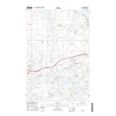
2017 Map of Lacey
USGS Topo · Published 2017About this map
Henderson Inlet and the southern reaches of Puget Sound define the northern edge of this Thurston County landscape, where the growing urban corridors of Olympia and Lacey meet established residential pockets and historic sites. The map documents a complex network of glacial prairies and kettle lakes, including Hicks Lake, Long Lake, and Pattison Lake, which shaped the early development of the region. Local history is anchored by sites like the Ruddell Pioneer-Woodlawn Cem and Saint Martin's Univ, while names like Union Mill and Hawks Prairie recall the area's timber and agricultural roots.
Find a feature on this map
249 named features on this map. Tap any name to fly to it.
Don’t see what you’re looking for? This feature index may not catch every label — zoom into the map to look around manually.
Map Details
Editions of this 2017 Lacey Map
This is the sole edition of this map. No revisions or reprints were ever made.
Other maps of this area

1916 · Chehalis
USGS Topo · 1:125,000

1937 · Olympia
USGS Topo · 1:62,500

1940 · Tenino
USGS Topo · 1:62,500

1940 · Anderson Island
USGS Topo · 1:62,500

1944 · Tenino
USGS Topo · 1:62,500

1944 · Yelm
USGS Topo · 1:62,500

1948 · Anderson Island
USGS Topo · 1:62,500

1948 · Nisqually
USGS Topo · 1:24,000

1948 · Anderson Island
USGS Topo · 1:24,000

1949 · Yelm
USGS Topo · 1:62,500