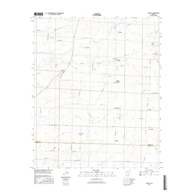
2017 Map of Ladelle
USGS Topo · Published 2017About this map
The boundary between Drew and Ashley counties defines the southern portion of this landscape, where small rural settlements like Ladelle and Lacey serve as local hubs. This territory is heavily dissected by the winding tributaries of the Panther Creek system, including the N Fork Panther Cr and S Fork Panther Cr. These drainage patterns influenced the placement of early homesteads and cemeteries, many of which carry distinct local names.
Find a feature on this map
74 named features on this map. Tap any name to fly to it.
Don’t see what you’re looking for? This feature index may not catch every label — zoom into the map to look around manually.
Map Details
Editions of this 2017 Ladelle Map
This is the sole edition of this map. No revisions or reprints were ever made.
Other maps of this area

1935 · Mist
USGS Topo · 1:62,500

1935 · Cominto
USGS Topo · 1:62,500

1952 · Fountain Hill
USGS Topo · 1:24,000

1953 · Greenwood
USGS Topo · 1:250,000

1956 · Greenwood
USGS Topo · 1:250,000

1960 · Mist
USGS Topo · 1:62,500

1960 · Collins
USGS Topo · 1:62,500
1960 · Mist
USGS Topo · 1:24,000

1960 · Cominto
USGS Topo · 1:24,000
1960 · Mist NW
USGS Topo · 1:24,000