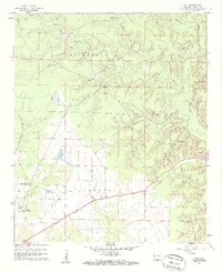
1960 Map of Mist
USGS Topo · Published 1961About this map
The lowlands of Banner Prairie and the Bearhouse Bayou dominate this 1960 landscape in Ashley County, where the Missouri Pacific railroad cuts a diagonal line toward the settlement of Mist. This survey captures the agricultural and timber character of the region, marked by numerous small cemeteries such as Central Cem, Griswold Cem, and Powell Cem, which likely served the surrounding farmsteads and the community of Berea.
Find a feature on this map
30 named features on this map. Tap any name to fly to it.
Don’t see what you’re looking for? This feature index may not catch every label — zoom into the map to look around manually.
Map Details
Editions of this 1960 Mist Map
2 editions found
Other maps of this area

1935 · Mist
USGS Topo · 1:62,500

1935 · Wilmot
USGS Topo · 1:62,500

1952 · Fountain Hill
USGS Topo · 1:24,000

1953 · Greenwood
USGS Topo · 1:250,000

1956 · Greenwood
USGS Topo · 1:250,000

1960 · Snyder
USGS Topo · 1:24,000

1960 · Mist
USGS Topo · 1:62,500

1960 · Wilmot
USGS Topo · 1:62,500
1960 · Portland
USGS Topo · 1:24,000

1960 · Wilmot NW
USGS Topo · 1:24,000