
1960 Map of Wilmot
USGS Topo · Published 1961About this map
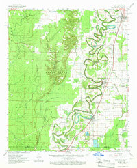
Bayou Bartholomew winds in dramatic oxbows through this 1960 landscape, defining the character of the borderlands between Arkansas and Louisiana. The terrain is a complex network of waterways, including Enterprise Lake, Bartholomew Lake, and numerous sloughs such as Billottis Slough and Walkers Slough. The Missouri Pacific railroad serves as the primary industrial spine, connecting the established communities of Portland, Parkdale, and Wilmot.
Find a feature on this map
85 named features on this map. Tap any name to fly to it.
Don’t see what you’re looking for? This feature index may not catch every label — zoom into the map to look around manually.
Map Details
Editions of this 1960 Wilmot Map
2 editions found
Other maps of this area

1935 · Mist
USGS Topo · 1:62,500

1935 · Wilmot
USGS Topo · 1:62,500

1935 · Naff
USGS Topo · 1:62,500

1935 · Oak Grove
USGS Topo · 1:62,500

1935 · Bonita
USGS Topo · 1:62,500

1936 · Eudora
USGS Topo · 1:62,500

1936 · Lake Village
USGS Topo · 1:62,500

1952 · Fountain Hill
USGS Topo · 1:24,000

1953 · Greenwood
USGS Topo · 1:250,000

1955 · Jackson
USGS Topo · 1:250,000