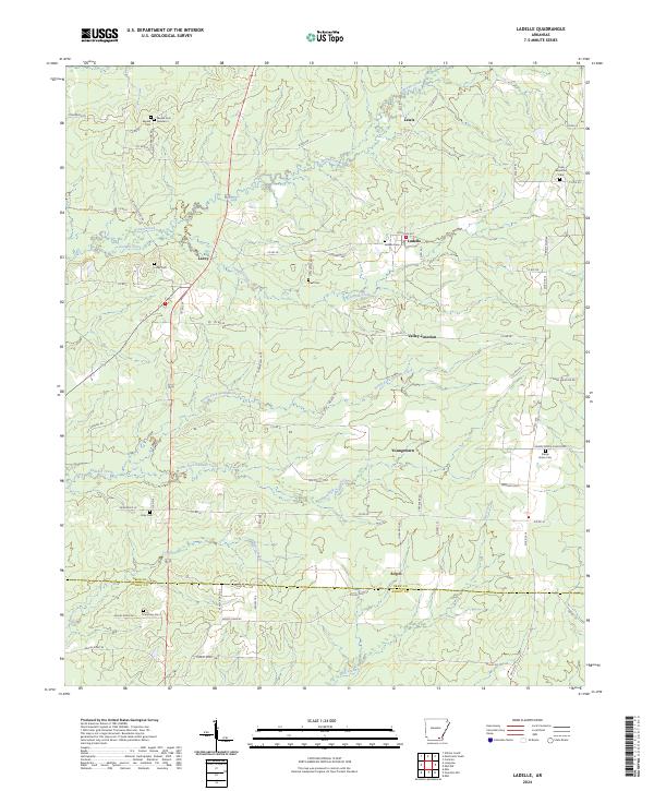
2024 Map of Ladelle
USGS Topo · Published 2024About this map
Lacey and Ladelle anchor this rural landscape in southeastern Arkansas, where small hamlets are interconnected by a dense network of county roads. The terrain is defined by the branching tributaries of the Panther Creek system, including North Fork Panther Creek and South Fork Panther Creek, which carve winding paths through the timberlands and fields. To the north, Lewis sits near the headwaters of Brown Creek, while the southern reaches descend toward the boundary of Drew County and Ashley County.
Find a feature on this map
74 named features on this map. Tap any name to fly to it.
Don’t see what you’re looking for? This feature index may not catch every label — zoom into the map to look around manually.
Map Details
Editions of this 2024 Ladelle Map
This is the sole edition of this map. No revisions or reprints were ever made.
Other maps of this area

1935 · Mist
USGS Topo · 1:62,500

1935 · Cominto
USGS Topo · 1:62,500

1952 · Fountain Hill
USGS Topo · 1:24,000

1953 · Greenwood
USGS Topo · 1:250,000

1956 · Greenwood
USGS Topo · 1:250,000

1960 · Mist
USGS Topo · 1:62,500

1960 · Collins
USGS Topo · 1:62,500
1960 · Mist
USGS Topo · 1:24,000

1960 · Cominto
USGS Topo · 1:24,000
1960 · Mist NW
USGS Topo · 1:24,000