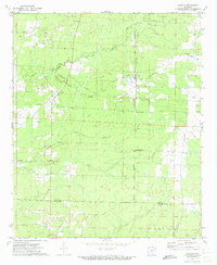
1971 Map of Ladelle
USGS Topo · Published 1973About this map
The quiet timberlands and small-scale farms of southeast Arkansas are captured here in the early 1970s, where the landscape is defined by the headwaters of several drainage systems. Small rural communities like Lacey and Ladelle serve as local anchors, connected by a network of unimproved roads and the prominent Old Railroad Grade that cuts diagonally across the terrain toward Valley Junction. This rail corridor, along with the numerous Gravel Pits scattered near Brown Creek, points to the region's industrial reliance on natural resource extraction.
Find a feature on this map
23 named features on this map. Tap any name to fly to it.
Don’t see what you’re looking for? This feature index may not catch every label — zoom into the map to look around manually.
Map Details
Editions of this 1971 Ladelle Map
This is the sole edition of this map. No revisions or reprints were ever made.
Other maps of this area

1935 · Mist
USGS Topo · 1:62,500

1935 · Cominto
USGS Topo · 1:62,500

1952 · Fountain Hill
USGS Topo · 1:24,000

1953 · Greenwood
USGS Topo · 1:250,000

1956 · Greenwood
USGS Topo · 1:250,000

1960 · Mist
USGS Topo · 1:62,500

1960 · Collins
USGS Topo · 1:62,500
1960 · Mist
USGS Topo · 1:24,000

1960 · Cominto
USGS Topo · 1:24,000
1960 · Mist NW
USGS Topo · 1:24,000