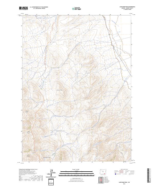
2024 Map of Ladycomb Peak
USGS Topo · Published 2024About this map
Ladycomb Peak stands as the central high point in this remote corner of Harney County, presiding over a landscape defined by the drainage systems of the Pueblo Mountains. The terrain transitions from the heights of Oleachea Pass and Rough Canyon in the southwest down toward the Pueblo Valley in the northeast. Water management and natural hydrology are central to the area's character, with an intricate network of waterways including South Fork Willow Creek, Little Cottonwood Creek, and the curiously named Willow Creek Pockets.
Find a feature on this map
26 named features on this map. Tap any name to fly to it.
Don’t see what you’re looking for? This feature index may not catch every label — zoom into the map to look around manually.
Map Details
Editions of this 2024 Ladycomb Peak Map
This is the sole edition of this map. No revisions or reprints were ever made.
Other maps of this area

1955 · Adel
USGS Topo · 1:250,000

1957 · Adel
USGS Topo · 1:250,000

1958 · Adel
USGS Topo · 1:250,000

1962 · Adel
USGS Topo · 1:250,000

1971 · Fields Basin
USGS Topo · 1:24,000

1971 · Fields
USGS Topo · 1:24,000

1971 · Borax Lake
USGS Topo · 1:24,000
1981 · Colony Ranch
USGS Topo · 1:24,000
1981 · Van Horn Basin
USGS Topo · 1:24,000
1981 · Tumtum Lake
USGS Topo · 1:24,000