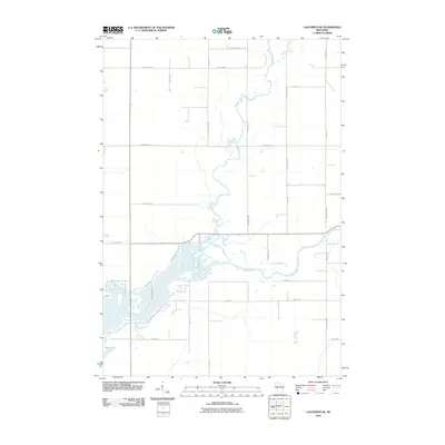
2010 Map of Ladysmith SE
USGS Topo · Published 2010About this map
The Jump River winds through this rural Wisconsin landscape, joined by the meandering course of Main Creek as it flows south toward the Chippewa River basin. At this time in 2010, the region is defined by its agricultural grid, where long-established section lines are traced by thoroughfares like Rangeline Rd and Marshall Rd. The confluence of waterways in the southern half of the quadrangle creates a complex network of backwaters and small islands, notably near Pine Island Rd.
Find a feature on this map
32 named features on this map. Tap any name to fly to it.
Don’t see what you’re looking for? This feature index may not catch every label — zoom into the map to look around manually.
Map Details
Editions of this 2010 Ladysmith SE Map
This is the sole edition of this map. No revisions or reprints were ever made.
Other maps of this area

1947 · Sheldon
USGS Topo · 1:48,000

1948 · Ladysmith
USGS Topo · 1:48,000

1949 · Sheldon
USGS Topo · 1:48,000

1950 · Ladysmith
USGS Topo · 1:48,000

1951 · Cornell
USGS Topo · 1:62,500

1951 · Gilman
USGS Topo · 1:62,500

1953 · Rice Lake
USGS Topo · 1:250,000

1959 · Rice Lake
USGS Topo · 1:250,000
1971 · Ladysmith
USGS Topo · 1:24,000
1971 · Thornapple
USGS Topo · 1:24,000