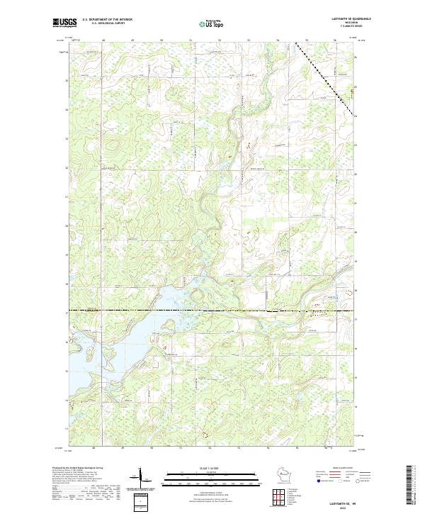
2022 Map of Ladysmith SE
USGS Topo · Published 2022About this map
The Jump River flows through this corner of Rusk and Chippewa Counties, defining the lower portion of a landscape shaped by glacial hydrology and rural development. This 2022 survey captures a transition point where the Main Creek and Skunk Cr drain toward the river through a mosaic of woodlots and established farmsteads. The road network, including the intersection of State Hwy 194 and Co Hwy D, reflects a late-modern rural infrastructure that follows the section lines of the Public Land Survey System. In the southwest, Roedecker Lake serves as a significant local landmark, surrounded by residential roads such as Whispering Pines Dr. This map is particularly valuable for documenting the modern configuration of property boundaries and local routes like Oakridge Rd and Broken Arrow Rd as they appeared in the early 2020s.
Find a feature on this map
55 named features on this map. Tap any name to fly to it.
Don’t see what you’re looking for? This feature index may not catch every label — zoom into the map to look around manually.
Map Details
Editions of this 2022 Ladysmith SE Map
This is the sole edition of this map. No revisions or reprints were ever made.
Other maps of this area

1947 · Sheldon
USGS Topo · 1:48,000

1948 · Ladysmith
USGS Topo · 1:48,000

1949 · Sheldon
USGS Topo · 1:48,000

1950 · Ladysmith
USGS Topo · 1:48,000

1951 · Cornell
USGS Topo · 1:62,500

1951 · Gilman
USGS Topo · 1:62,500

1953 · Rice Lake
USGS Topo · 1:250,000

1959 · Rice Lake
USGS Topo · 1:250,000
1971 · Ladysmith
USGS Topo · 1:24,000
1971 · Thornapple
USGS Topo · 1:24,000