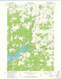
1971 Map of Ladysmith SE
USGS Topo · Published 1974About this map
Jump River Flowage dominates the southwestern portion of this 1971 survey, where the rising waters of the Holcombe Elevation 1044 project transformed the confluence of the Jump River. The landscape reflects a shift from traditional rural farming towards water-based recreation and power generation, evidenced by the development around Paradise Point. Despite these changes, older civic anchors remain visible, such as the Willard Sch Townhall located further north in the town of Willard. Away from the flowage, the terrain is defined by the winding paths of Main Creek and Skunk Creek, cutting through a mix of woodland and agricultural clearings. This document captures the region during a period when the newly created shoreline was still defining the local geography and road network.
Find a feature on this map
6 named features on this map. Tap any name to fly to it.
Don’t see what you’re looking for? This feature index may not catch every label — zoom into the map to look around manually.
Map Details
Editions of this 1971 Ladysmith SE Map
This is the sole edition of this map. No revisions or reprints were ever made.
Other maps of this area

1947 · Sheldon
USGS Topo · 1:48,000

1948 · Ladysmith
USGS Topo · 1:48,000

1949 · Sheldon
USGS Topo · 1:48,000

1950 · Ladysmith
USGS Topo · 1:48,000

1951 · Cornell
USGS Topo · 1:62,500

1951 · Gilman
USGS Topo · 1:62,500

1953 · Rice Lake
USGS Topo · 1:250,000

1959 · Rice Lake
USGS Topo · 1:250,000
1971 · Ladysmith
USGS Topo · 1:24,000
1971 · Thornapple
USGS Topo · 1:24,000