
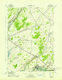
1943 Map of Lafargeville
USGS Topo · Published 1943About this map
Lafargeville stands as the central hub of this Jefferson County landscape, where the New York Central railroad and the Chaumont River intersect. During the early 1940s, the rural character of the region was defined by a dense network of numbered schoolhouses, such as School No 12 and School No 10, indicating a well-distributed agrarian population across the townships of Orleans and Alexandria. The mapping, conducted by the Tennessee Valley Authority for the War Department, captures a detailed layout of small family settlements like Tanners Corner and Orleans Four Corners. Genealogists will find significant value in the numerous burial grounds documented, including Hinman Cem, St Johns Cem, and Perch Lake Cem near the shores of Perch Lake. Small waterways like Carter Creek and Hyde Creek thread through the woodlots and fields, illustrating the drainage patterns of this northern New York terrain.
Find a feature on this map
32 named features on this map. Tap any name to fly to it.
Don’t see what you’re looking for? This feature index may not catch every label — zoom into the map to look around manually.
Map Details
Editions of this 1943 Lafargeville Map
This is the sole edition of this map. No revisions or reprints were ever made.
Other maps of this area

1900 · Clayton
USGS Topo · 1:62,500

1903 · Grindstone
USGS Topo · 1:62,500

1903 · Clayton
USGS Topo · 1:62,500

1903 · Alexandria Bay
USGS Topo · 1:62,500

1903 · Theresa
USGS Topo · 1:62,500

1942 · Clayton
USGS Topo · 1:24,000
1943 · Dexter
USGS Topo · 1:31,680

1943 · Thousand Island Park
USGS Topo · 1:31,680

1943 · Redwood
USGS Topo · 1:31,680

1943 · Clayton
USGS Topo · 1:31,680