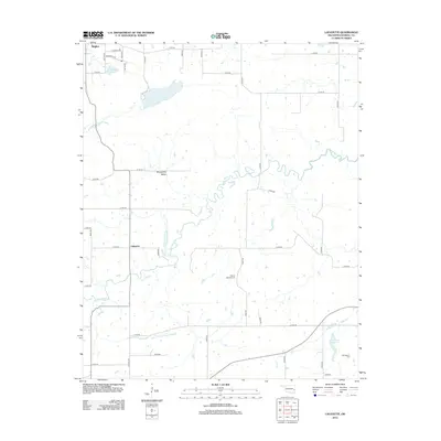
2012 Map of Lafayette
USGS Topo · Published 2012About this map
Sans Bois Cr winds through the heart of this Haskell County landscape, defining the hydrology of the rural corridor between Lafayette and the southern outskirts of Stigler. The map documents a predominantly agricultural region where the grid-like road network, including routes like E1270 Rd and N4480 Rd, intersects with the natural topography of Shropshire Valley. Local history and genealogy are anchored by small burial grounds such as Siloam Springs Cem and Old Panther Cem, which serve as vital landmarks for tracing early settlement patterns.
Find a feature on this map
43 named features on this map. Tap any name to fly to it.
Don’t see what you’re looking for? This feature index may not catch every label — zoom into the map to look around manually.
Map Details
Editions of this 2012 Lafayette Map
This is the sole edition of this map. No revisions or reprints were ever made.
Other maps of this area

1900 · Sansbois
USGS Topo · 1:125,000

1900 · Sallisaw
USGS Topo · 1:125,000

1909 · Sans Bois
USGS Topo · 1:125,000

1911 · Sallisaw
USGS Topo · 1:125,000

1911 · Sansbois
USGS Topo · 1:125,000

1946 · Fort Smith
USGS Topo · 1:250,000

1962 · Stigler East
USGS Topo · 1:24,000

1962 · Stigler West
USGS Topo · 1:24,000

1965 · Fort Smith
USGS Topo · 1:250,000

1967 · Fort Smith
USGS Topo · 1:250,000