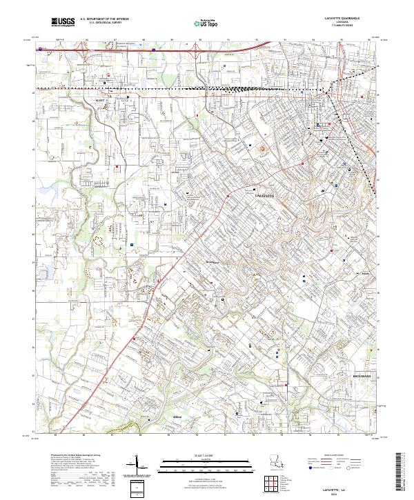
2024 Map of Lafayette
USGS Topo · Published 2024About this map
Lafayette and the surrounding Acadiana region are defined by a complex network of bayous and modern transit corridors in this contemporary survey. The Vermilion River snakes through the heart of the landscape, joined by drainage features like Coulee Mine and Coulee Ile des Cannes. This area shows the dense institutional fabric of the parish seat, anchored by the University of Louisiana at Lafayette and the South Louisiana Community College. Local history is preserved in a high concentration of memorial sites, from the Jewish Cem and Lafayette Protestant Cem in the urban center to more secluded locations like Simon Cem and Whittington Cem. The transition from the commercial density of Ambassador Caffery Pkwy to the outlying settlements of Scott, Milton, and Broussard illustrates the continued expansion of the metropolitan footprint along historical land divisions.
Find a feature on this map
44 named features on this map. Tap any name to fly to it.
Don’t see what you’re looking for? This feature index may not catch every label — zoom into the map to look around manually.
Map Details
Editions of this 2024 Lafayette Map
This is the sole edition of this map. No revisions or reprints were ever made.
Other maps of this area

1934 · Duson
USGS Topo · 1:31,680

1939 · St. Martinsville
USGS Topo · 1:62,500

1940 · Arnaudville
USGS Topo · 1:62,500

1946 · Milton
USGS Topo · 1:31,680

1946 · Leroy
USGS Topo · 1:31,680

1946 · Lafayette
USGS Topo · 1:31,680

1952 · Lake Charles
USGS Topo · 1:250,000

1954 · Lafayette
USGS Topo · 1:31,680

1954 · Duson
USGS Topo · 1:31,680
1954 · Leroy
USGS Topo · 1:31,680