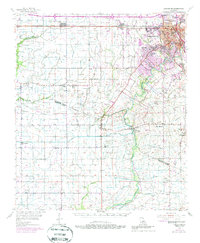
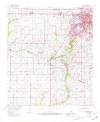
1955 Map of Lafayette
USGS Topo · Published 1986About this map
The Vermilion River carves through the heart of this mid-century Louisiana landscape, serving as a central artery for the growing city of Lafayette. Beyond the urban core, the map reveals a complex web of drainage coulees, such as Coulee de Carencro and Coulee de Anselm, which define the low-lying terrain of the Cajun heartland. The economic life of the era is evidenced by the Southern Pacific railroad lines connecting Duson and Scott, alongside the emerging Duson Gas Field and scattered oil wells that denote the region's industrial shift. For genealogists, the map is a dense record of family and community landmarks, featuring several country burial sites including Bethel Cem, Abshire Cem, and Petry Cem. Educational hubs like Judice High Sch and Southside Sch are documented alongside smaller rural settlements such as Ridge, Meaux, and Andrew, showing the distribution of the population across the prairies and bayous before widespread modern expansion.
Find a feature on this map
72 named features on this map. Tap any name to fly to it.
Don’t see what you’re looking for? This feature index may not catch every label — zoom into the map to look around manually.
Map Details
Editions of this 1955 Lafayette Map
5 editions found
Other maps of this area

1932 · Abbeville NE
USGS Topo · 1:31,680

1932 · Abbeville NW
USGS Topo · 1:31,680

1934 · Duson
USGS Topo · 1:31,680

1935 · Branch
USGS Topo · 1:31,680

1937 · Derouen
USGS Topo · 1:62,500

1939 · St. Martinsville
USGS Topo · 1:62,500

1940 · Arnaudville
USGS Topo · 1:62,500

1945 · New Orleans
USGS Topo · 1:250,000

1946 · Milton
USGS Topo · 1:31,680

1946 · Leroy
USGS Topo · 1:31,680