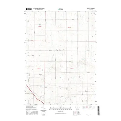
2015 Map of Lafayette
USGS Topo · Published 2015About this map
Lafayette and Alburnett anchor the landscape of northern Linn County in this modern survey. The area is defined by the drainages of W Otter Cr and E Otter Cr, which cut through the agricultural sections of t85n r7w and t86n r8w. For genealogists, the map is particularly useful for its documentation of small rural burial grounds that dot the countryside, including Oliphant Cem, Ashlock Cem, and Alice Cem near the small settlement of Alice. The infrastructure follows a rigid grid of country roads such as Central City RD and Troy Mills RD, reflecting the enduring Public Land Survey System. These routes connect the scattered farmsteads and historic centers of these prairie townships, providing a clear view of the region's contemporary rural character.
Find a feature on this map
69 named features on this map. Tap any name to fly to it.
Don’t see what you’re looking for? This feature index may not catch every label — zoom into the map to look around manually.
Map Details
Editions of this 2015 Lafayette Map
This is the sole edition of this map. No revisions or reprints were ever made.
Other maps of this area

1888 · Shellsburg
USGS Topo · 1:62,500

1888 · Marion
USGS Topo · 1:62,500

1889 · Marion
USGS Topo · 1:62,500

1889 · Shellsburg
USGS Topo · 1:62,500

1899 · Shellsburg
USGS Topo · 1:62,500

1903 · Winthrop
USGS Topo · 1:125,000

1959 · Dubuque
USGS Topo · 1:250,000

1961 · Dubuque
USGS Topo · 1:250,000

1962 · Dubuque
USGS Topo · 1:250,000
1967 · Cedar Rapids North
USGS Topo · 1:24,000