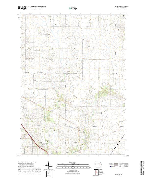
2022 Map of Lafayette
USGS Topo · Published 2022About this map
The rolling agricultural landscape of northern Linn County is defined by the converging drainage of W Otter Cr and E Otter Cr. Small rural hubs like Alice and Lafayette anchor a network of section-line roads, including Central City Rd and Troy Mills Rd, while the larger settlement of Alburnett appears in the southeast. This area retains many of its original pioneer-era burial sites, from West Prairie Cem in the north to Oliphant Cem further south.
Find a feature on this map
70 named features on this map. Tap any name to fly to it.
Don’t see what you’re looking for? This feature index may not catch every label — zoom into the map to look around manually.
Map Details
Editions of this 2022 Lafayette Map
This is the sole edition of this map. No revisions or reprints were ever made.
Other maps of this area

1888 · Shellsburg
USGS Topo · 1:62,500

1888 · Marion
USGS Topo · 1:62,500

1889 · Marion
USGS Topo · 1:62,500

1889 · Shellsburg
USGS Topo · 1:62,500

1899 · Shellsburg
USGS Topo · 1:62,500

1903 · Winthrop
USGS Topo · 1:125,000

1959 · Dubuque
USGS Topo · 1:250,000

1961 · Dubuque
USGS Topo · 1:250,000

1962 · Dubuque
USGS Topo · 1:250,000
1967 · Cedar Rapids North
USGS Topo · 1:24,000