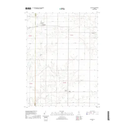
2018 Map of Lafayette
USGS Topo · Published 2018About this map
La Fayette and the western outskirts of Toulon define the northern landscape of this Stark County region, where the prairie is dissected by the branching headwaters of Walnut Creek and Indian Cr. The map reveals a deeply rooted rural infrastructure of section-line roads and family-linked landmarks. Genealogists will find significant value in the documentation of several small burial grounds, including Shockley Cem, McClenahan Cem, and the LaFayette Cem.
Find a feature on this map
55 named features on this map. Tap any name to fly to it.
Don’t see what you’re looking for? This feature index may not catch every label — zoom into the map to look around manually.
Map Details
Editions of this 2018 Lafayette Map
This is the sole edition of this map. No revisions or reprints were ever made.
Other maps of this area

1931 · Galva
USGS Topo · 1:48,000

1940 · Galva
USGS Topo · 1:62,500

1941 · Maquon
USGS Topo · 1:62,500

1943 · Maquon
USGS Topo · 1:62,500

1944 · Galva
USGS Topo · 1:62,500

1944 · Kewanee
USGS Topo · 1:62,500

1944 · Elmwood
USGS Topo · 1:62,500

1948 · Elmwood
USGS Topo · 1:62,500
1953 · Galva
USGS Topo · 1:24,000

1958 · Burlington
USGS Topo · 1:250,000