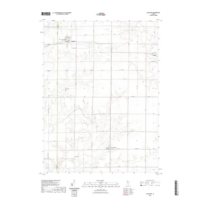
2021 Map of Lafayette
USGS Topo · Published 2021About this map
La Fayette and the surrounding Stark County farmstead landscape appear here alongside the western edge of Toulon. The village of Lafayette is clearly delineated with its street grid, featuring Washington St and Adams St, while the local history of the area is preserved in the location of several rural burying grounds. Genealogists can identify the LaFayette Cem north of town, the McClenahan Cem further south, and the Shockley Cem near the banks of Walnut Creek.
Find a feature on this map
36 named features on this map. Tap any name to fly to it.
Don’t see what you’re looking for? This feature index may not catch every label — zoom into the map to look around manually.
Map Details
Editions of this 2021 Lafayette Map
This is the sole edition of this map. No revisions or reprints were ever made.
Other maps of this area

1931 · Galva
USGS Topo · 1:48,000

1940 · Galva
USGS Topo · 1:62,500

1941 · Maquon
USGS Topo · 1:62,500

1943 · Maquon
USGS Topo · 1:62,500

1944 · Galva
USGS Topo · 1:62,500

1944 · Kewanee
USGS Topo · 1:62,500

1944 · Elmwood
USGS Topo · 1:62,500

1948 · Elmwood
USGS Topo · 1:62,500
1953 · Galva
USGS Topo · 1:24,000

1958 · Burlington
USGS Topo · 1:250,000