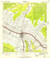
1938 Map of Lafourche
USGS Topo · Published 1938About this map
Bayou Lafourche serves as the central artery for this 1938 landscape, where the traditional plantation economy and burgeoning rail infrastructure intersect. The survey reveals a corridor of historical estates including Greenwood Plantation, Abby Plantation, and Laurel Valley Plantation, illustrating the persistent linear settlement pattern common to South Louisiana. The city of Thibodaux stands as the primary hub, anchored by the Texas and Pacific and Southern Pacific railroads which converge at Thibodaux Junction.
Find a feature on this map
35 named features on this map. Tap any name to fly to it.
Don’t see what you’re looking for? This feature index may not catch every label — zoom into the map to look around manually.
Map Details
Editions of this 1938 Lafourche Map
This is the sole edition of this map. No revisions or reprints were ever made.
Other maps of this area

1892 · Lac Des Allemands
USGS Topo · 1:62,500

1892 · Gibson
USGS Topo · 1:62,500

1892 · Houma
USGS Topo · 1:62,500

1892 · Thibodaux
USGS Topo · 1:62,500

1897 · Gibson
USGS Topo · 1:62,500

1927 · Thibodaux NW
USGS Topo · 1:31,680

1932 · Lac Des Allemands NW
USGS Topo · 1:31,680

1932 · Lac Des Allemands SW
USGS Topo · 1:31,680

1932 · Thibodaux NE
USGS Topo · 1:31,680

1932 · Houma NW
USGS Topo · 1:31,680