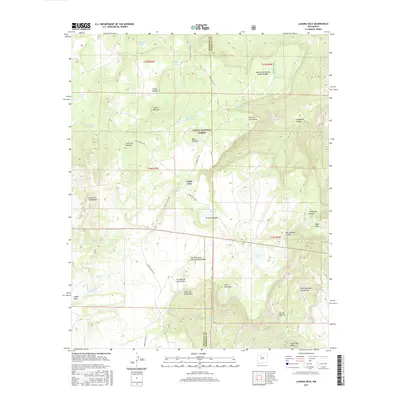
2017 Map of Laguna Seca
USGS Topo · Published 2017About this map
Cibola National Forest encompasses much of this high-altitude terrain, where the boundary between McKinley and Sandoval counties divides a landscape of deep canyons and volcanic mesas. The settlement of Eagle Nest sits centrally, surrounded by a complex system of seasonal water catchments such as Eagle Nest Tank and Horse Pasture Stock Tank, reflecting the region's reliance on managed water for livestock and forestry.
Find a feature on this map
45 named features on this map. Tap any name to fly to it.
Don’t see what you’re looking for? This feature index may not catch every label — zoom into the map to look around manually.
Map Details
Editions of this 2017 Laguna Seca Map
This is the sole edition of this map. No revisions or reprints were ever made.
Other maps of this area

1883 · Mt. Taylor
USGS Topo · 1:250,000

1886 · Mt. Taylor
USGS Topo · 1:250,000

1892 · Mt. Taylor
USGS Topo · 1:250,000

1899 · Mt. Taylor
USGS Topo · 1:250,000

1958 · Albuquerque
USGS Topo · 1:250,000

1961 · Marquez
USGS Topo · 1:24,000

1961 · Cerro Parido
USGS Topo · 1:24,000

1961 · Cerro Tinaja
USGS Topo · 1:24,000

1961 · El Dado Mesa
USGS Topo · 1:24,000
1961 · La Gotera
USGS Topo · 1:24,000