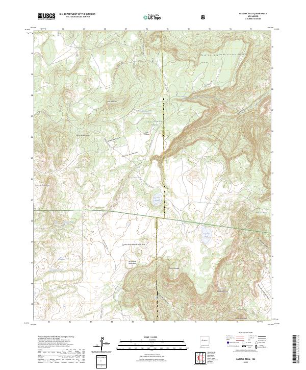
2023 Map of Laguna Seca
USGS Topo · Published 2023About this map
Cibola National Forest spans a high-desert landscape defined by complex mesas and seasonal water sources along the boundary of McKinley and Sandoval counties. The terrain is dominated by prominent elevations such as Mesa Chivato and Santa Rosa Peaks, while drainage systems like Guadalupe Canyon and Cañon de Santa Rosa carve deep into the plateau. This map reveals a reliance on essential water points in an arid environment, noting numerous springs and tanks including Ojo del la Cobra, Pinabeta Tank, and the eponymous Laguna Seca. The presence of several "Ojos" and the Valle de las Animas reflects the deep cultural history of Spanish-named landmarks in this high-altitude region. Ranching infrastructure is evident through features like the Horse Pasture Stock Tank, showing how the land was managed within the forest boundaries.
Find a feature on this map
41 named features on this map. Tap any name to fly to it.
Don’t see what you’re looking for? This feature index may not catch every label — zoom into the map to look around manually.
Map Details
Editions of this 2023 Laguna Seca Map
This is the sole edition of this map. No revisions or reprints were ever made.
Other maps of this area

1883 · Mt. Taylor
USGS Topo · 1:250,000

1886 · Mt. Taylor
USGS Topo · 1:250,000

1892 · Mt. Taylor
USGS Topo · 1:250,000

1899 · Mt. Taylor
USGS Topo · 1:250,000

1958 · Albuquerque
USGS Topo · 1:250,000

1961 · Marquez
USGS Topo · 1:24,000

1961 · Cerro Parido
USGS Topo · 1:24,000

1961 · Cerro Tinaja
USGS Topo · 1:24,000

1961 · El Dado Mesa
USGS Topo · 1:24,000
1961 · La Gotera
USGS Topo · 1:24,000