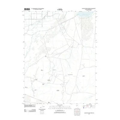
2011 Map of Lahontan Mountains
USGS Topo · Published 2011About this map
The Lahontan Mountains dominate this high-desert landscape in Churchill County, where the stark transition from mountain peaks to alluvial basins is clearly defined. Along the northern edge, the presence of the Stillwater Point Reservoir and Stillwater Slough indicates the vital role of water management in this arid region, connecting with the New River Slough and Lower Diagonal Drain to facilitate drainage and irrigation. The settlement of Salt Wells sits near the base of Salt Wells Mountain, marking a key transition point in the valley. Local industry and infrastructure are represented by the Gravel Pit Windmill, while several named peaks like Eagles House, Rainbow Mountain, and Eetz Mountain provide distinct navigational markers. The map also traces a network of rural roads such as Churchill Rd and Agency Rd, illustrating the human footprint across Churchill Valley and Wyemaha Valley.
Find a feature on this map
25 named features on this map. Tap any name to fly to it.
Don’t see what you’re looking for? This feature index may not catch every label — zoom into the map to look around manually.
Map Details
Editions of this 2011 Lahontan Mountains Map
This is the sole edition of this map. No revisions or reprints were ever made.
Other maps of this area

1908 · Carson Sink
USGS Topo · 1:250,000

1910 · Carson Sink
USGS Topo · 1:250,000

1950 · Stillwater
USGS Topo · 1:62,500

1951 · Carson Lake
USGS Topo · 1:62,500

1957 · Reno
USGS Topo · 1:250,000

1959 · Reno
USGS Topo · 1:250,000

1960 · Reno
USGS Topo · 1:250,000

1969 · Foxtail Lake
USGS Topo · 1:24,000

1972 · Fourmile Flat
USGS Topo · 1:24,000

1972 · Diamond Canyon
USGS Topo · 1:24,000