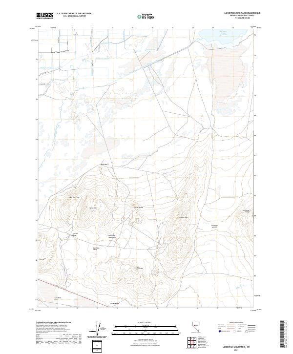
2021 Map of Lahontan Mountains
USGS Topo · Published 2021About this map
The Lahontan Mountains dominate this high-desert landscape in Churchill County, where the stark elevation of the Stillwater Range meets the complex hydrology of the Great Basin. The southern reaches of the quadrangle are defined by the Salt Wells Basin and the small settlement of Salt Wells, situated at the base of Salt Wells Mtn. This area reflects the extreme environmental shifts of the region, where dry lake beds and peaks like Sehoo Mtn and Morrison Peak stand in contrast to the heavily managed water systems of the north.
Find a feature on this map
32 named features on this map. Tap any name to fly to it.
Don’t see what you’re looking for? This feature index may not catch every label — zoom into the map to look around manually.
Map Details
Editions of this 2021 Lahontan Mountains Map
This is the sole edition of this map. No revisions or reprints were ever made.
Other maps of this area

1908 · Carson Sink
USGS Topo · 1:250,000

1910 · Carson Sink
USGS Topo · 1:250,000

1950 · Stillwater
USGS Topo · 1:62,500

1951 · Carson Lake
USGS Topo · 1:62,500

1957 · Reno
USGS Topo · 1:250,000

1959 · Reno
USGS Topo · 1:250,000

1960 · Reno
USGS Topo · 1:250,000

1969 · Foxtail Lake
USGS Topo · 1:24,000

1972 · Fourmile Flat
USGS Topo · 1:24,000

1972 · Diamond Canyon
USGS Topo · 1:24,000