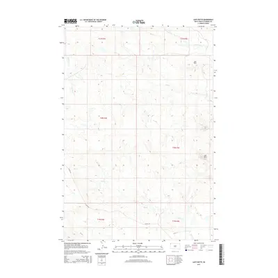
2015 Map of Lahti Butte
USGS Topo · Published 2015About this map
Lahti Butte stands as a prominent landmark in this corner of Harding County, anchoring a landscape defined by its high plains topography and intermittent drainage systems. The survey reveals a sparse network of watercourses, including Cottonwood Creek in the north and the meandering Rush Creek to the south. Human activity is centered around the lone arterial corridor of Clanton Rd, which cuts diagonally across the Public Land Survey System grid. This map documents the persistent township and range divisions of Northwest South Dakota, showing the relationship between natural features like Mud Butte and the geometric boundaries of t20n r4e and t19n r3e. The terrain represents the characteristic open grazing lands of the region, where named landmarks and creek beds serve as the primary navigational markers for local ranchers and land managers.
Find a feature on this map
13 named features on this map. Tap any name to fly to it.
Don’t see what you’re looking for? This feature index may not catch every label — zoom into the map to look around manually.
Map Details
Editions of this 2015 Lahti Butte Map
This is the sole edition of this map. No revisions or reprints were ever made.
Other maps of this area

1935 · Buffalo
USGS Topo · 1:125,000

1954 · Lemmon
USGS Topo · 1:250,000

1957 · Lemmon
USGS Topo · 1:250,000

1969 · Ladner
USGS Topo · 1:24,000

1969 · Ladner SE
USGS Topo · 1:24,000

1971 · Buffalo
USGS Topo · 1:24,000
1971 · Lahti Butte
USGS Topo · 1:24,000

1971 · McKenzie Butte
USGS Topo · 1:24,000

1971 · Saddle Butte
USGS Topo · 1:24,000

1973 · Gallup Creek
USGS Topo · 1:24,000