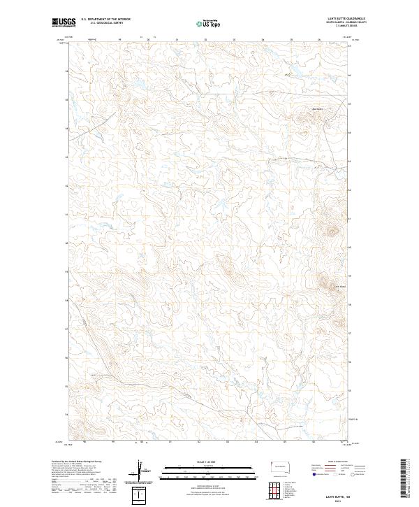
2021 Map of Lahti Butte
USGS Topo · Published 2021About this map
Lahti Butte and Mud Butte dominate this portion of Harding County, serving as primary vertical landmarks in an expansive landscape defined by its drainage systems. Several intermittent watercourses, including Rush Creek, Jones Creek, and Cottonwood Creek, carve their way through the terrain, illustrating the hydrologic patterns of the northern plains. This 2021 survey reflects the modern rural infrastructure of the region, where Clanton Road provides one of the few named access routes through the various townships and ranges. The map details the precise boundaries of the Public Land Survey System, including t20n r4e and t21n r3e, making it a valuable tool for understanding current land divisions and topographical features in this part of South Dakota.
Find a feature on this map
13 named features on this map. Tap any name to fly to it.
Don’t see what you’re looking for? This feature index may not catch every label — zoom into the map to look around manually.
Map Details
Editions of this 2021 Lahti Butte Map
This is the sole edition of this map. No revisions or reprints were ever made.
Other maps of this area

1935 · Buffalo
USGS Topo · 1:125,000

1954 · Lemmon
USGS Topo · 1:250,000

1957 · Lemmon
USGS Topo · 1:250,000

1969 · Ladner
USGS Topo · 1:24,000

1969 · Ladner SE
USGS Topo · 1:24,000

1971 · Buffalo
USGS Topo · 1:24,000
1971 · Lahti Butte
USGS Topo · 1:24,000

1971 · McKenzie Butte
USGS Topo · 1:24,000

1971 · Saddle Butte
USGS Topo · 1:24,000

1973 · Gallup Creek
USGS Topo · 1:24,000