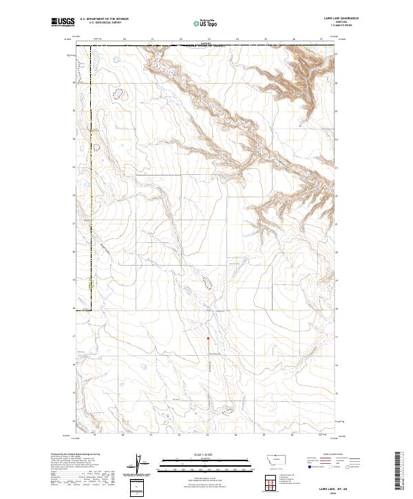
2024 Map of Laird Lake
USGS Topo · Published 2024About this map
The sparsely populated northern plains of Hill County, Montana, are represented here in a landscape defined by intermittent drainages and natural depressions. The primary hydrologic feature is Laird Lake, a notable basin within an area otherwise characterized by long, slow-running coulees and broad township divisions. This region, situated along the international border with Canada, reflects the vast agricultural and grazing lands that dominate the northern High Plains, where human settlement is widely dispersed and centered around essential water sources and established county roads. The mapping of this quadrangle illustrates the enduring rural character of the state’s northern tier, providing a detailed record of the terrain and surveyed land sections as they exist in the modern day.
Find a feature on this map
2 named features on this map. Tap any name to fly to it.
Don’t see what you’re looking for? This feature index may not catch every label — zoom into the map to look around manually.
Map Details
Editions of this 2024 Laird Lake Map
This is the sole edition of this map. No revisions or reprints were ever made.
Other maps of this area

1919 · Alma
USGS Topo · 1:125,000

1954 · Shelby
USGS Topo · 1:250,000

1958 · Shelby
USGS Topo · 1:250,000

1963 · Bobcat Coulee SE
USGS Topo · 1:24,000
1964 · Bobcat Coulee NE
USGS Topo · 1:24,000

1972 · Goldstone SW
USGS Topo · 1:24,000

1972 · Mc Kinnsey Reservoir West
USGS Topo · 1:24,000
1972 · Goldstone
USGS Topo · 1:24,000
1972 · Laird Lake
USGS Topo · 1:24,000
1984 · Chester
USGS Topo · 1:100,000