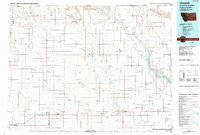
1984 Map of Chester
USGS Topo · Published 1984About this map
The High Line of northern Montana unfolds across this mid-1980s landscape, where a series of small grain-belt settlements track the essential path of the Burlington Northern railroad. Running parallel to the international border with Canada, towns such as Chester, Joplin, Inverness, Rudyard, and Kremlin are tied together by this vital transportation corridor. The northern portion of the map is defined by the arid drainage patterns of Sage Creek and McKinney Reservoir, while the eastern section is dominated by the sprawling waters of the Fresno Reservoir and the winding course of the Milk River. The presence of the Sage Creek Colony in the northwest corner highlights the region's distinct communal agricultural heritage. Notable landforms like Rattlesnake Butte and Black Butte rise above the surrounding plains, providing orientation points in a landscape characterized by deep coulees like O'Brien Coulee and Ninemile Coulee.
Find a feature on this map
46 named features on this map. Tap any name to fly to it.
Don’t see what you’re looking for? This feature index may not catch every label — zoom into the map to look around manually.
Map Details
Editions of this 1984 Chester Map
This is the sole edition of this map. No revisions or reprints were ever made.
Other maps of this area

1904 · Assinniboine
USGS Topo · 1:62,500

1904 · Boxelder
USGS Topo · 1:62,500

1906 · Kremlin
USGS Topo · 1:62,500

1906 · Boxelder
USGS Topo · 1:62,500

1912 · Thibedeau Lake
USGS Topo · 1:125,000

1919 · Big Sandy
USGS Topo · 1:125,000

1919 · Alma
USGS Topo · 1:125,000

1920 · Gildford
USGS Topo · 1:125,000

1943 · Gildford
USGS Topo · 1:125,000

1953 · Havre
USGS Topo · 1:250,000