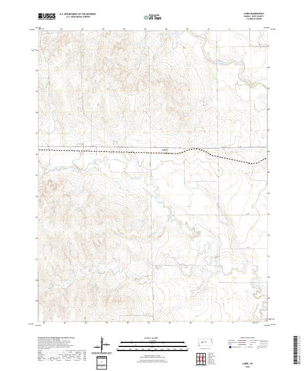
2022 Map of Laird
USGS Topo · Published 2022About this map
The settlement of Laird sits at the center of this Ness County landscape, situated along the local thoroughfare of J Rd. This western Kansas terrain is defined by the drainage systems of two major waterways, the N Fork Walnut Cr to the north and the S Fork Walnut Cr to the south. The map reflects a meticulously gridded agricultural and transport network, dominated by local connectors such as Co Rd 525 and L Rd. These survey lines, including the boundaries of t18s r25w and t19s r25w, trace the deep-rooted Public Land Survey System that organized this region of the High Plains for settlement and ranching.
Find a feature on this map
12 named features on this map. Tap any name to fly to it.
Don’t see what you’re looking for? This feature index may not catch every label — zoom into the map to look around manually.
Map Details
Editions of this 2022 Laird Map
This is the sole edition of this map. No revisions or reprints were ever made.
Other maps of this area

1892 · Ness
USGS Topo · 1:125,000

1893 · Ellis
USGS Topo · 1:125,000

1894 · Ness
USGS Topo · 1:125,000

1955 · Great Bend
USGS Topo · 1:250,000

1955 · Scott City
USGS Topo · 1:250,000

1957 · Great Bend
USGS Topo · 1:250,000

1958 · Great Bend
USGS Topo · 1:250,000

1958 · Scott City
USGS Topo · 1:250,000

1965 · Beeler
USGS Topo · 1:24,000

1965 · Utica SW
USGS Topo · 1:24,000