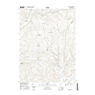
2016 Map of Lairdsville
USGS Topo · Published 2016About this map
Muncy Hills rise above the complex drainage patterns of the Lycoming and Columbia county line, where headwaters and small runs carve deep into the northern Pennsylvania landscape. This 2016 survey highlights the agrarian and rural character of the region, anchored by established hamlets like Lairdsville and Unityville. The terrain is defined by prominent elevations such as Northside Ridge and Buck Ridge, which separate the various watercourses including Little Muncy Creek and the southern Little Fishing Creek.
Find a feature on this map
101 named features on this map. Tap any name to fly to it.
Don’t see what you’re looking for? This feature index may not catch every label — zoom into the map to look around manually.
Map Details
Editions of this 2016 Lairdsville Map
This is the sole edition of this map. No revisions or reprints were ever made.
Other maps of this area

1894 · Bloomsburg
USGS Topo · 1:62,500

1927 · Eagles Mere
USGS Topo · 1:48,000

1932 · Eagle Mere
USGS Topo · 1:62,500

1934 · Laporte
USGS Topo · 1:62,500

1935 · Hughesville
USGS Topo · 1:62,500

1947 · Bloomsburg
USGS Topo · 1:24,000

1947 · Benton
USGS Topo · 1:31,680
1953 · Bloomsburg
USGS Topo · 1:24,000
1953 · Benton
USGS Topo · 1:24,000

1953 · Hughesville
USGS Topo · 1:62,500
Featured Places
- Greenwood Township, PA
- Moreland Township, PA
- Pine Township, PA
- Lairdsville, Franklin Township
- Pine Summit, Pine Township