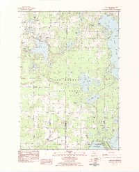
1983 Map of Lake Ann
USGS Topo · Published 1984About this map
The Pere Marquette State Forest dominates the central portion of this 1983 survey, where the Platte River winds through a dense network of glacial lakes. In the north, the village of Lake Ann sits between its namesake water body and smaller features like Bryan Lake. Further south, the landscape transitions into the established educational and cultural hub of Interlochen, home to the Interlochen Center for the Arts and Interlochen State Park. The map documents a rural transition zone along the Benzie and Grand Traverse county line, where traditional homesteading sites like Inland Corners and Bendon are marked by their local cemeteries and country churches. Genealogists can locate several burial grounds, including the Old Inland Cem and Mt Hope Cem, while the road network of Fewins Road and Old Grade Road reveals the region's historical transit patterns between these small woodland communities.
Find a feature on this map
78 named features on this map. Tap any name to fly to it.
Don’t see what you’re looking for? This feature index may not catch every label — zoom into the map to look around manually.
Map Details
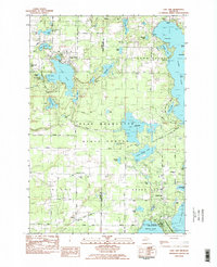
Editions of this 1983 Lake Ann Map
2 editions found
Other maps of this area

1954 · Traverse City
USGS Topo · 1:250,000

1956 · Kingsley
USGS Topo · 1:62,500

1956 · Thompsonville
USGS Topo · 1:62,500

1957 · Traverse City
USGS Topo · 1:62,500

1957 · Maple City
USGS Topo · 1:62,500

1958 · Traverse City
USGS Topo · 1:250,000

1976 · Thompsonville NE
USGS Topo · 1:24,000
1976 · Thompsonville SW
USGS Topo · 1:24,000

1976 · Thompsonville NW
USGS Topo · 1:24,000

1976 · Thompsonville SE
USGS Topo · 1:24,000
Featured Places
- Long Lake Township, MI
- Long Lake Charter Township, Long Lake Township
- Green Lake Township, MI
- Interlochen, Green Lake Township
- Hardwood Acres, MI