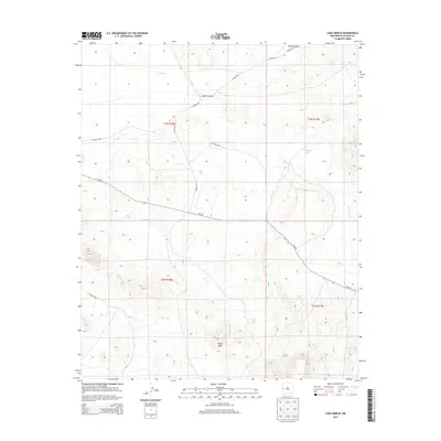
2013 Map of Lake Armijo
USGS Topo · Published 2013About this map
Eagle Peak rises as a prominent landmark in this high-desert region of western New Mexico, where the landscape is defined by drainage systems and seasonal water sources. The map captures a transition between the expansive drainage of Nations Draw and the winding course of Largo Cr. This area of Catron County is sparsely populated, yet characterized by essential water management features like Eagle Tank and the titular Lake Armijo. A network of local infrastructure, including CO Road A034 and NM-601, connects these remote reaches. The topography reveals a series of basins and depressions, including Jeremillas Lake, which likely serve as focal points for cattle ranching and local land use in an arid environment where water is the primary architect of the settlement pattern.
Find a feature on this map
17 named features on this map. Tap any name to fly to it.
Don’t see what you’re looking for? This feature index may not catch every label — zoom into the map to look around manually.
Map Details
Editions of this 2013 Lake Armijo Map
This is the sole edition of this map. No revisions or reprints were ever made.
Other maps of this area

1954 · Saint Johns
USGS Topo · 1:250,000

1957 · Saint Johns
USGS Topo · 1:250,000

1958 · Saint Johns
USGS Topo · 1:250,000

1962 · Saint Johns
USGS Topo · 1:250,000

1972 · Zuni Salt Lake
USGS Topo · 1:24,000

1972 · Lake Armijo
USGS Topo · 1:24,000

1972 · Tejana Mesa
USGS Topo · 1:24,000
1972 · Cerro Prieto
USGS Topo · 1:24,000

1972 · Fence Lake SW
USGS Topo · 1:24,000

1972 · Blaines Lake
USGS Topo · 1:24,000