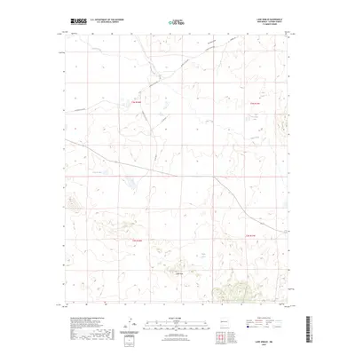
2023 Map of Lake Armijo
USGS Topo · Published 2023About this map
Eagle Peak rises as a prominent landmark in this high-desert portion of Catron County, overlooking a landscape defined by seasonal water sources and ranching infrastructure. The arid terrain is marked by ephemeral features such as Largo Creek and Nations Draw, which channel runoff during the occasional heavy rains. These drainage patterns influenced the placement of early reservoirs like Lake Armijo, Jeremillas Lake, and the Eagle Tank, vital for sustaining livestock in this open range. A network of rural routes, including Hubbell Rd and various county roads, connects the distant parcels across the township and range lines. The map reveals the persistent reliance on natural and man-made catchment basins to manage the high-altitude environment of Western New Mexico.
Find a feature on this map
17 named features on this map. Tap any name to fly to it.
Don’t see what you’re looking for? This feature index may not catch every label — zoom into the map to look around manually.
Map Details
Editions of this 2023 Lake Armijo Map
This is the sole edition of this map. No revisions or reprints were ever made.
Other maps of this area

1954 · Saint Johns
USGS Topo · 1:250,000

1957 · Saint Johns
USGS Topo · 1:250,000

1958 · Saint Johns
USGS Topo · 1:250,000

1962 · Saint Johns
USGS Topo · 1:250,000

1972 · Zuni Salt Lake
USGS Topo · 1:24,000

1972 · Lake Armijo
USGS Topo · 1:24,000

1972 · Tejana Mesa
USGS Topo · 1:24,000
1972 · Cerro Prieto
USGS Topo · 1:24,000

1972 · Fence Lake SW
USGS Topo · 1:24,000

1972 · Blaines Lake
USGS Topo · 1:24,000