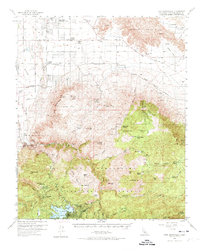
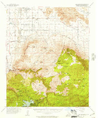
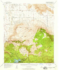
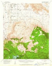
1956 Map of Lake Arrowhead
USGS Topo · Published 1974About this map
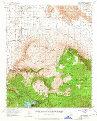
Lake Arrowhead and the surrounding resort communities of Blue Jay, Cedar Glen, and Deer Lodge Park define the southern landscape of this mid-century survey. While the southern portion is characterized by the dense timber of the San Bernardino National Forest, the topography shifts dramatically to the north into the arid Victor Valley and Lucerne Valley. This transition is marked by the presence of the Atchison Topeka and Santa Fe Railroad cutting through the high desert floor past Apple Valley.
Find a feature on this map
76 named features on this map. Tap any name to fly to it.
Don’t see what you’re looking for? This feature index may not catch every label — zoom into the map to look around manually.
Map Details
Editions of this 1956 Lake Arrowhead Map
5 editions found
Other maps of this area

1896 · San Bernardino
USGS Topo · 1:62,500

1898 · San Bernardino
USGS Topo · 1:62,500

1899 · Redlands
USGS Topo · 1:62,500

1901 · Southern California Sheet No. 1
USGS Topo · 1:250,000

1901 · San Bernardino
USGS Topo · 1:62,500

1901 · Redlands
USGS Topo · 1:62,500

1902 · Deep Creek
USGS Topo · 1:62,500

1902 · Hesperia
USGS Topo · 1:62,500

1902 · San Gorgonio
USGS Topo · 1:125,000

1904 · Southern California Sheet No. 1
USGS Topo · 1:250,000