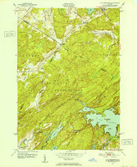
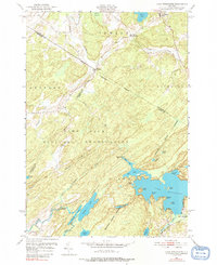
1951 Map of Lake Bonaparte
USGS Topo · Published 1952About this map
The Camp Drum Military Reservation dominates this 1950s landscape, its strictly defined Military Reservation Boundary cutting across the complex terrain of Lewis and Jefferson counties. This expansive federal installation encompasses a mosaic of wetlands and water bodies, including Indian River and Bonaparte Creek, creating a distinct separation between military grounds and the civilian townships of Diana, Pitcairn, and Fowler.
Find a feature on this map
41 named features on this map. Tap any name to fly to it.
Don’t see what you’re looking for? This feature index may not catch every label — zoom into the map to look around manually.
Map Details
Editions of this 1951 Lake Bonaparte Map
5 editions found
Other maps of this area

1911 · Antwerp
USGS Topo · 1:62,500

1912 · Hammond
USGS Topo · 1:62,500

1913 · Lake Bonaparte
USGS Topo · 1:62,500

1915 · Gouverneur
USGS Topo · 1:62,500

1916 · Lake Bonaparte
USGS Topo · 1:62,500

1937 · Gouverneur
USGS Topo · 1:62,500

1944 · Hammond
USGS Topo · 1:62,500

1948 · Ogdensburg
USGS Topo · 1:250,000

1949 · Hammond
USGS Topo · 1:62,500

1949 · Antwerp
USGS Topo · 1:62,500